🌍 Romania
6 min read
A lot of people from Cluj and the neighbouring cities know famous spots like: Cheile Turzii, Piatra Secuiului or Tarnița Lake. But we're going to talk today about 3 lesser-known destinations that are really capturing the beauty of these mountains.
Cheile Vălișoarei
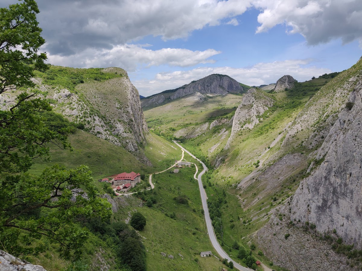
The first destination is in Trascău mountains, a limestone chain that spans along the east side of Apuseni. Cheile Vălișoarei are 1 hour away from Cluj, on the road that passes through Rimetea, with the popular Piatra Secuiului hike. A few km down the valley, you pass through the Vălișoara village and then the road goes straight through the Vălișoara (or Aiud) Gorges. This is a paved road, so you won't have any trouble getting there.
There are two hiking options here, the right ridge and the left ridge. For the most beautiful views, we recommend the right ridge circuit. Being a circuit, you have two ways of doing it. We hiked the opposite direction then the one described on munții-noștri, because we weren't sure we wanted to do the whole circuit at first.
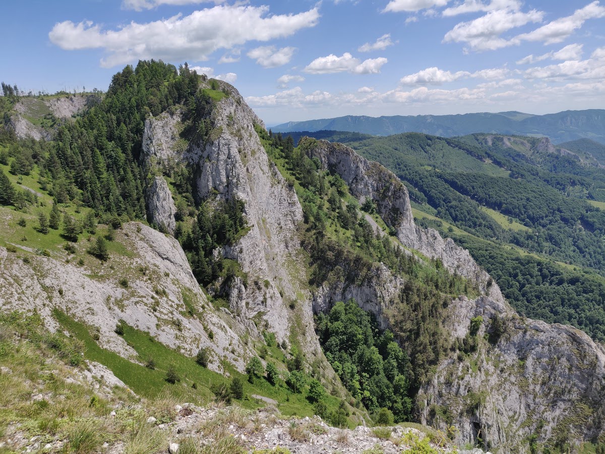
We crossed the medieval fortress (turned into a hotel) next to the road and started going up towards the edge of the cliff rising 200 meters above the road. The view from here is simply breath-taking and there are multiple spots from which you can see the entire left ridge in front of you.
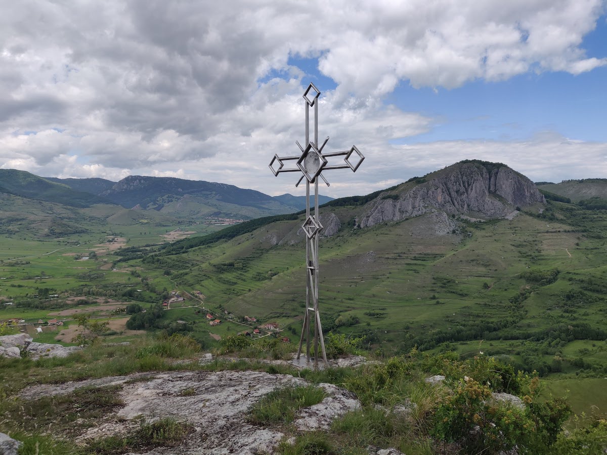
From here the track goes pretty flat until you reach a forest where you start the climb towards the highest point of the day, at 734m. You have another panoramic view of the entire area, the Vălișoara village and the surrounding mountains. There's a metal cross that marks the high point.
The trickiest part of the circuit starts here, as the terrain is rocky and can get slippery very fast. You have to be careful with your steps and you need good grip in your shoes. The trail then goes over a rocky area as it exits the forest and you end up on the main road where you started.
Depending on your fitness level and how much you stop for breaks, you can do the circuit in anything between 2 to 3 hours. The red dot marks the circuit and was recently refreshed (in 2020).
Scărița Belioara
From Trascău, we move a bit to the north to Băișoara and Muntele Mare, in the heart of Apuseni. Scărița Belioara is a huge rock formation at the southern end of the massif. Hiking trails in Muntele Mare are usually accessed through Băișoara. However, to get to Scărița Belioara, you'll have to drive along the Arieș river valley and take a right towards Poșaga de Sus. From here the road is unpaved for 8-9km until the trail, but totally drivable with a regular car. You can leave the car on the side of the road just as you arrive at the base of the mountain.
Again, there's a red dot circuit trail that you can follow. As a side note about trail marks, a dot is always a circuit, while lines and crosses mark one-way paths from A to B.
Scărița Belioara is a bit more difficult then Cheile Vălișoarei, because of the steepness and the total altitude difference. The hike can be done in both directions and we it did as described on munții-noștri.
As soon as you start, you need to leave the dirt road and follow the trail through a wooden door and into the woods. It took us 10-15 minutes to find this way, so having a map of the trail is super useful.
Gradually, the trail becomes steeper until you reach an open rocky area, probably the steepest part of the climb. From here, you enter a beautiful forest and you keep going up until you reach a meadow with great views of the surrounding valleys. Depending on the season, you will find here different types of colorful flowers.
The trail continues going up, but flattens as you cross the second forest, and you arrive at the junction with the trail that comes from Băișoara (blue cross). You are now on top of the mountain and you get beautiful views all the way to the cabins in Băișoara and Muntele Cacovei.
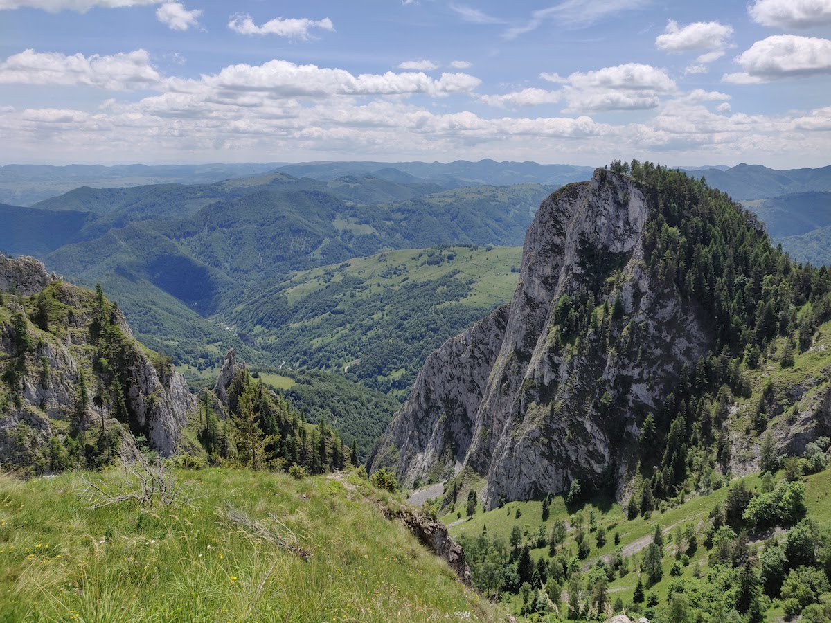
The next section of the hike is the most beautiful as you are on top of the rock formation. You can take secondary paths to the edge of the cliffs for breath-taking views of the valley bellow and the Trascău Mountains in the background.
The last part of the upper trail features a half-burned forested area. Unfortunately, the whole region is periodically affected by wild fires, so this is a common sight. Through this badly damaged land you start going downhill. You have to be careful here as there are a lot of fallen branches as it starts to get steeper.
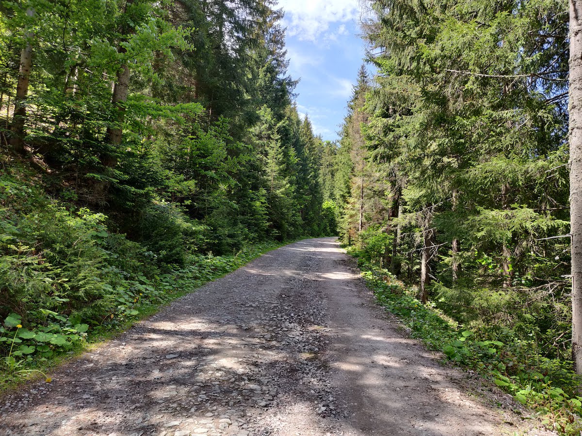
After about 500m, you arrive at a larger forest road which turns the last part of the hike into an enjoyable walk downhill. As you go down, on your right side, you will see the Coșul Boului cave and south-eastern wall of Scărița Belioara.
All in all, this hike takes between 4 and 6 hours, depending on how much time you spend on top. We had a beautiful summer day in 2019 and we were in no hurry to finish the hike, so we did it in around 5 hours.
Cucurbăta Mare
Apuseni mountains are not known for their heights, but you can have a great hiking experience going up the tallest peak in the mountain range. For this final trip, you will have to start early if you want to return to Cluj in the same day, as driving there takes about 3 hours one-way.
The route also goes on the Arieș valley, but this time you cross into Bihor county and you drive all the way to Arieșeni. As soon as you exit the village, you have to take a left on the unpaved DC255 road. Here is where the trail officially starts, the blue line that goes all the way to the top of the mountain.
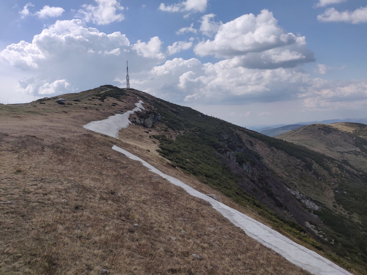
At 1849m, Cucurbăta Mare is the highest point in the Western Carpathian mountain chain. Now, if you have a 4x4 car, you can drive all the way to the top of the mountain, but we recommend mixing the drive with the hike. From the full length of 8km one-way, the first 4-5km can be done with a regular car with a decent ground clearance. You can leave your car on the side of the road at any point until here, but keep in mind you'll be walking back on the same road.
Soon after the 4km mark, you arrive at a sharp turn in the road, where the hiking trail and the road diverge. We left the cars pretty far out in Arieșeni and walked almost the entire distance of the common road. It's a nice walk but you can skip it if you are short on time.
From here, the trail starts with a pretty steep climb through a mix of forested and deforested areas. It's a pretty sustained effort uphill so it's better to be prepared with a slow and steady tempo. The upside of it is that you have a nice view of the mountain top as you go up, so you see where you are going.
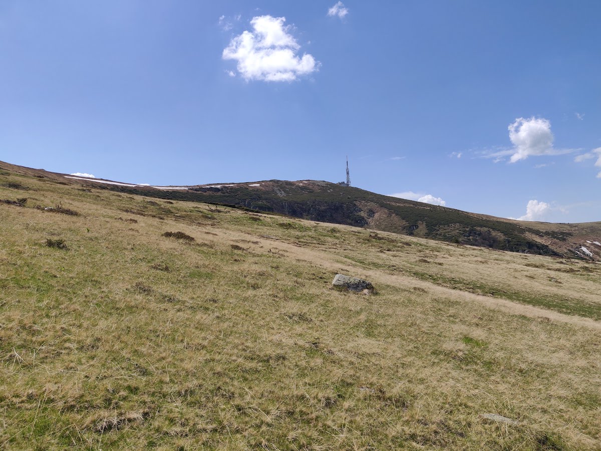
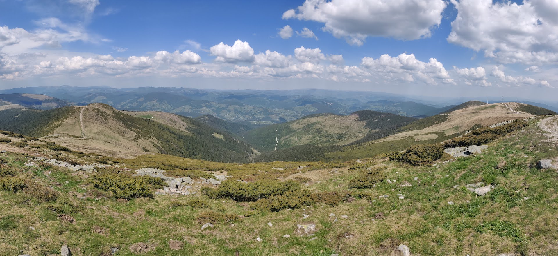
As you leave the forest behind you end up on a plateau with a lot of low trees and alpine grass. The hike is still uphill, but it gets easier. The final part intersects the dirt road that comes around the mountain. The top reveals a beautiful 360 degrees view of the entire Apuseni mountains.
In total we needed about 4 hours to reach to summit (including breaks) and 2 hours to get back, as you do a lot of fast walking downhill. As an alternative, you can reach the summit from Vârtop, a little further to the west from Arieșeni. But it's a longer hike that goes along the ridge of the Bihor mountain chain and reaches two other peaks before Cucurbăta Mare.
We hope this article gave you a few ideas for outdoor activities in the beautiful Apuseni mountains. Let us know what your favorite spots are and ping us on social media if you want other hiking recommendations in the area.