🌍 Romania
8 min read
Introduction
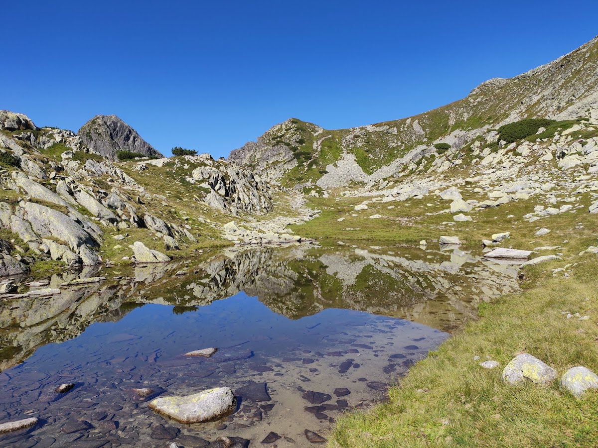
Bucura is the biggest glacier lake in Romania, with a surface of 8.9ha and a depth of 15 meters. It is situated in the heart of Retezat National Park, close to the main ridge of the mountain chain. It also hosts one of the only 3 camping spots in the park, so expect it to be bustling with people during the high season.
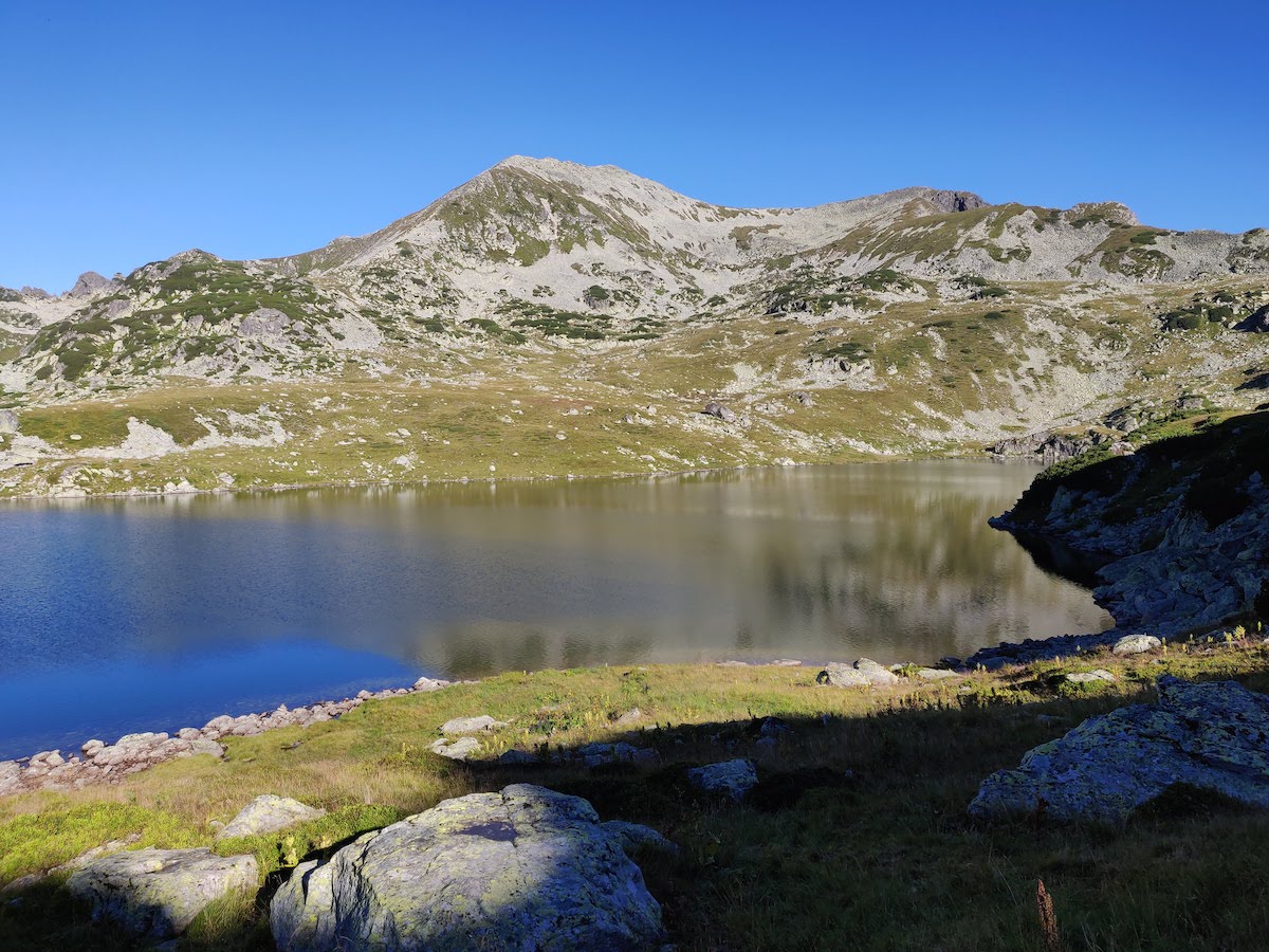
We arrived at the lake on a Thursday afternoon, to make sure we had a good tent spot for the weekend and we left on Sunday. But first things first, how do you get to Bucura?
Getting there
There are multiple ways to get to the lake. If you have a car that you're not afraid to use on a bad road, the easiest way is to drive to Poiana Pelegii and then hike uphill for about 2 hours. Other options require longer hikes and start from the other side of the ridge.
To get to Poiana Pelegii, you need to drive on a really bad road (even by Romanian standards). We recommend a high clearance car, like a mid-range SUV, although we saw small cars getting there as well. It also depends on your driving skills on rocky roads.
First you need to get to the Gura Apelor dam. The road until the dam is decent, except for the last 5-10km where you have to make your way around huge potholes. After you pass the dam, the asphalt disappears and you arrive at the entrance to the National Park. Here, you have to pay a small fee per person and per car.
From there, the road becomes really narrow, to the point where you have to negotiate with care each time you meet someone coming from the other direction. The road itself is not that bad here, it's just unpaved. You need some extra care at bridges and sharp turns, where the road might have some bumps.
There's one tricky section, 3km from the finish line, where you will see a lot of cars parked on the side of the road. Again, we saw small cars passing, so it depends on your skills and nerves behind the wheel. The "problematic" section is just 50-100 meters long, but it's very steep and rocky. Our Mazda CX-5 had no problems going over, just make sure you have enough speed at the base of the ramp.
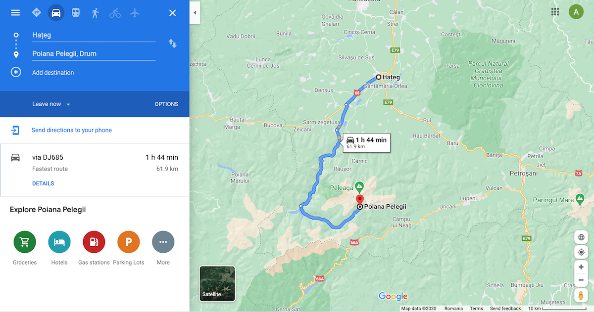
All in all, you should plan for at least 2 hours of driving starting from Hațeg, most of which will be spent in tricky conditions. Even Google Maps is optimistic about the 1h44min duration.
From Poiana Pelegii, at 1600m, you follow the blue line trail towards Bucura Lake, at over 2000m. The hike is mostly uphill, but not too difficult. If you carry camping equipment, plan for two hours. The first half is pretty lean, going through the forest and exiting into an area with a lot of low trees. Here, the terrain becomes rockier and you have to negotiate your way through small streams, slippery rocks and wet grass. The last part is dry and steeper, passing through several glacier plateaus until you arrive at the biggest one where Bucura formed.
Camping site
The camping site is located at the southern end of the lake, on a flat grassy area. It is packed with rock walls over the years by hikers to get cover from the wind.
We arrived during the early evening after two rainy days, so the land around the lake was pretty wet. There was no sun to warm us up so we quickly picked a spot encircled by rocks and set up our tent. It was a wise decision, as minutes after, the rain started. From inside the tent we could hear other hikers scrambling to assemble their tents. We were fortunate enough to stay dry and warm.
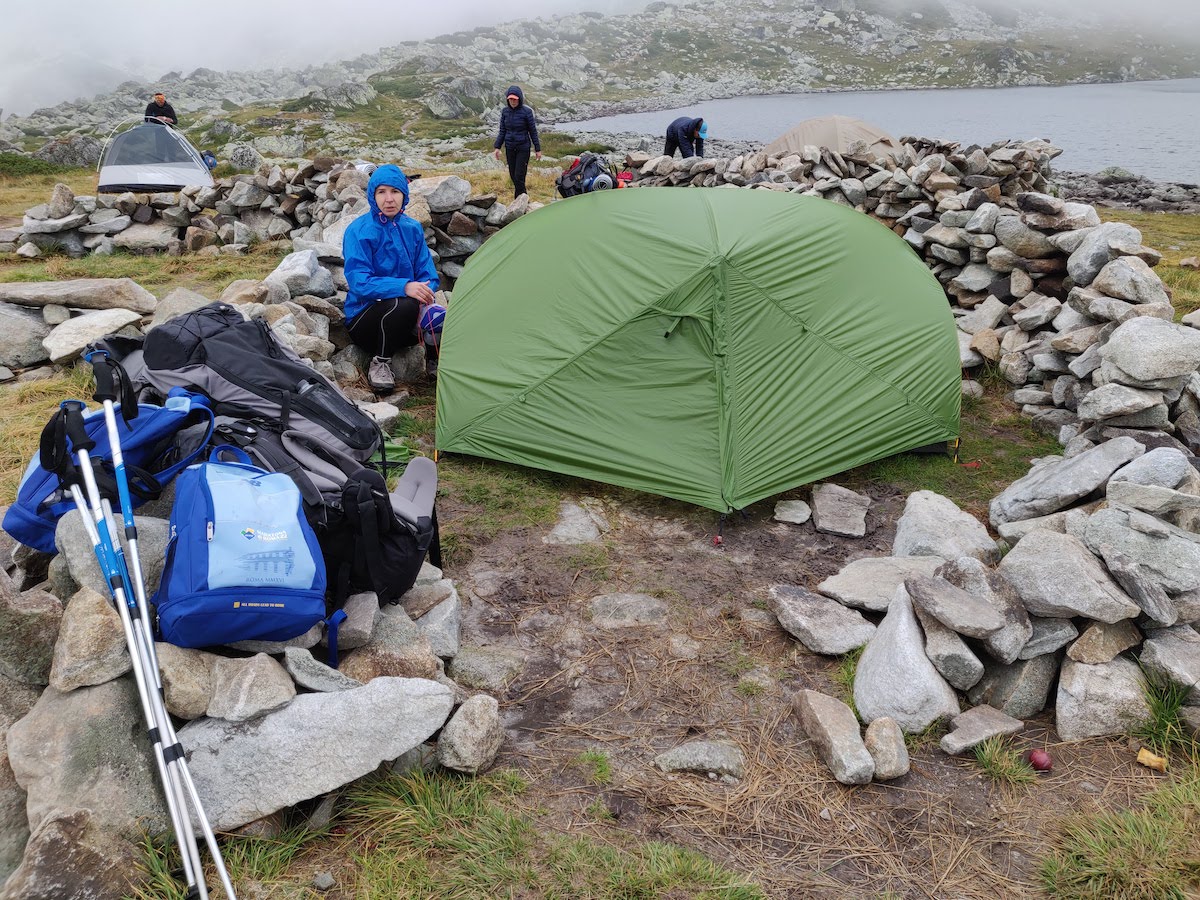
The mountain rescue cabin is located on the right side of the lake, as you look at it from the campsite.
Behind the mountain cabin, you can find two streams. They are impossible to miss.
Because the lake is surrounded by mountains, the sun reaches the campsite pretty late compared to other areas. We were there in late August and the sun was not hitting our tent until 8:30am. Also because of the remote location, there's no phone signal anywhere near the lake.
Hiking trips
We stayed for 3 nights so we had 2 full days of hiking in between. We decided to take it easy after doing a day hike of over 24km in Bucegi just a few days before. So we picked some classic hiking trips in the area.
Day 1 - Retezat Peak
After enjoying the morning sun and having breakfast by the tent, we decided to hike on the yellow line trail. The trail starts from Bucura and ends on the Retezat peak at 2482m.
Track Length
9.5km
Elevation Gain
716m
Time
6h
Marking
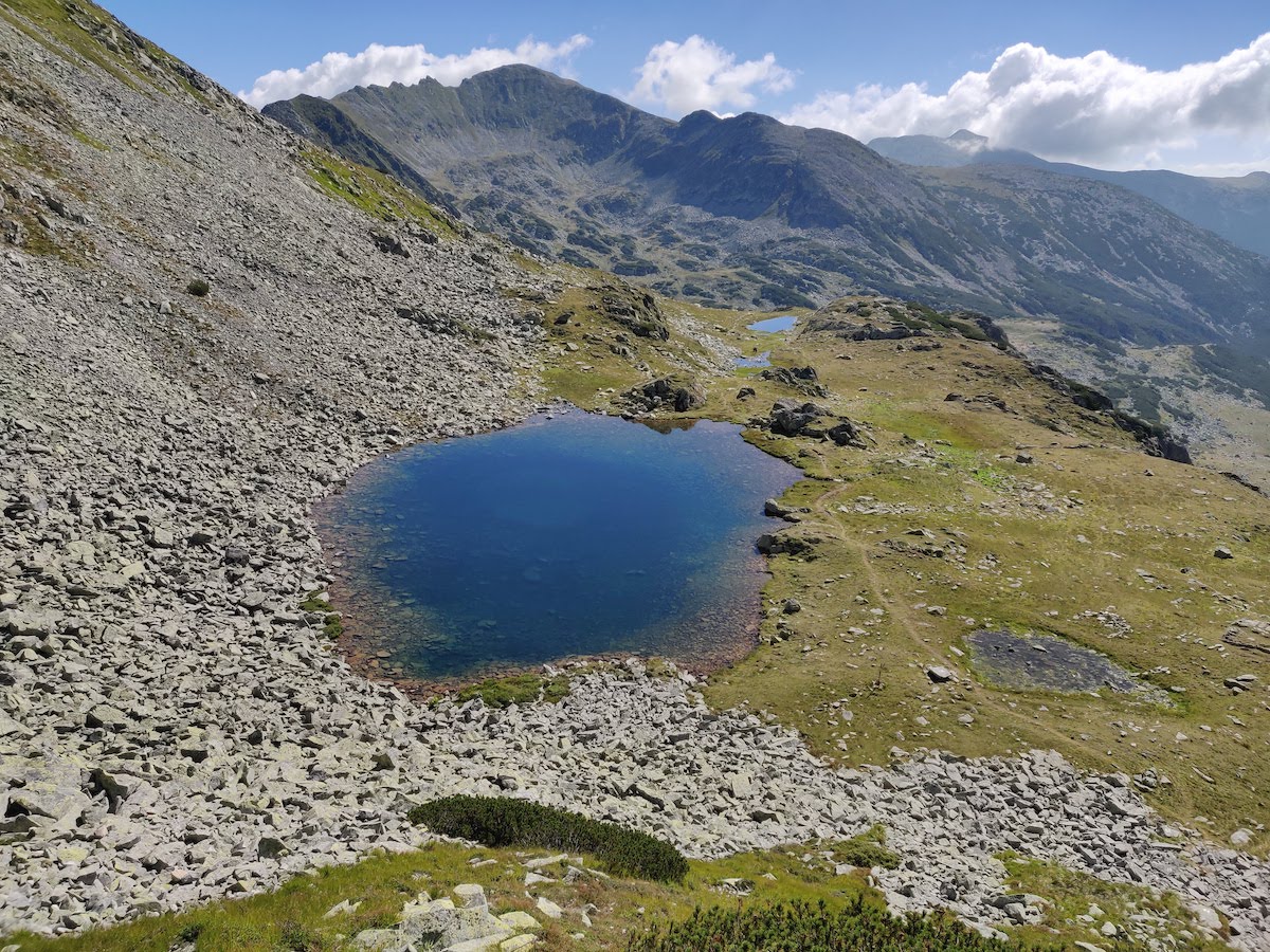
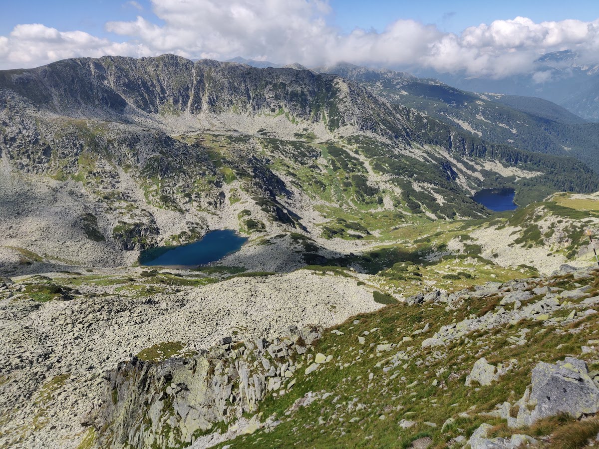
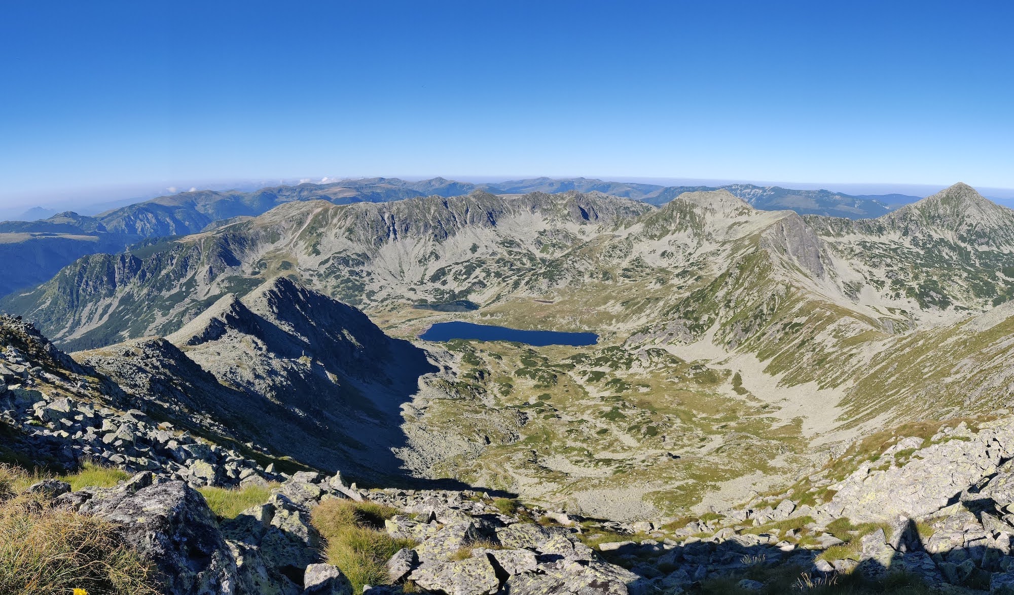
The first part is pretty relaxing, as you pass by Lake Bucurel towards Tăul Porții. This is one of the most beautiful lakes in the entire Bucura glacier valley.
From here, we started climbing towards Poarta Bucurei at 2280m. Then we continued towards the main ridge, intersecting the red line trail close to Bucura peak, just under the 2400m contour line.
Once you are above Poarta Bucurei, you start understanding why Retezat is the favorite mountain range for a lot of hikers in Romania. You start having amazing views of Bucura valley and Gemenele Scientific Reservation.
The most technical part begins after the intersection with the red line. There is a steep descent from the Bucura peak and a small section with cables, but nothing too scary or dangerous.
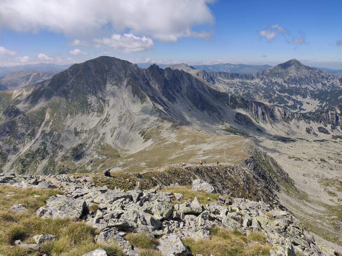
Once we passed the cable section, we started seeing on our right side the entire ridge of Retezat, all the way to Păpușa and Vârful Mare. In front of us lied the famous Retezat peak.
The trail goes up again after intersecting the blue triangle coming from Pietrele. There are 200m of altitude difference between the saddle and the peak, but the hardest part is the terrain made up of huge rocks, some of them a bit unstable.
This is a typical sight in Retezat, where very few peaks have dirt paths that go all the way to the top. Peleaga is an exception to this rule. You will definitely enjoy jumping from one rock to another once you get used to it, but overall this makes the hike a bit more difficult.
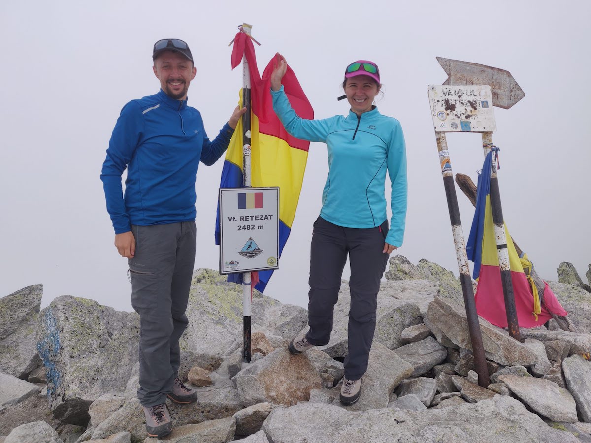
As we were approaching the peak, even before climbing down from Bucura, we saw that big clouds hover around Retezat. We were still hoping to catch a clean window while on top, but unfortunately we were in the clouds the entire time. That didn't stop us from grabbing lunch right next to the peak and taking some photos with the sign.
On the way back, the clouds became even thicker, to the point where they surrounded Bucura peak as well. However, we were determined to hike on a different path back to the lake. So as we arrived at Bucura, we continued on the red line trail, straight to the top of the mountain (2433m). Then we went down towards Curmătura Bucurei, where we took the blue line trail back to the campsite.
Bucura peak is similar with Retezat, but does not have a plateau at the top. Rather, the sign is placed right between the big boulders that are the highest points of the mountain. From here you get an amazing view towards Bucura lake, unless it's cloudy of course... We had to go down 50 meters or so to catch a glimpse of the lake below us.
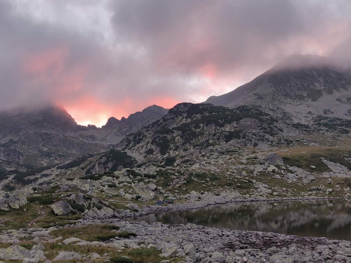
All in all, we spent about 5-6 hours hiking and 2 hours resting. We were back at our tents around 6pm, just in time for a well deserved dinner with a beautiful red sunset in the background. You can follow almost the entire hike on Relive.
Day 2 - Peleaga and Păpușa
We decided to leave for the second hike early in the morning, around 8:00am. Our goal was to arrive at Peleaga peak (2509m) and have breakfast there before too many people get to the top. On Friday a lot of people arrived at Bucura, so by Saturday morning there were close to 100 tents in the area.
Track Length
10.5km
Elevation Gain
1050m
Time
8h
Marking
Starting the mountain rescue cabin, the path towards Peleaga is marked with a yellow cross. It goes up on Valea Berbecilor until you take a sharp turn right and start going up on a very steep path towards the ridge.
Since we left early, we did most of the hike in the shadow, as the sun was not yet shining on the valley. It was pretty cold for a summer day, almost until we reached the top of the mountain.
As expected, there were very few people at the summit. We stayed for almost an hour, having breakfast at over 2500m and enjoying one of the most breathtaking views ever.
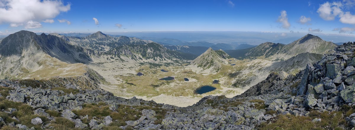
We continued on the red line trail towards the saddle between Peleaga and Păpușa. The descent is pretty steep and you have to be careful as you can easily slip on small rocks and dirt. Păpușa peak (2508m) is the smaller sister of Peleaga and features a more gentle incline, albeit with more rocky sections to climb.
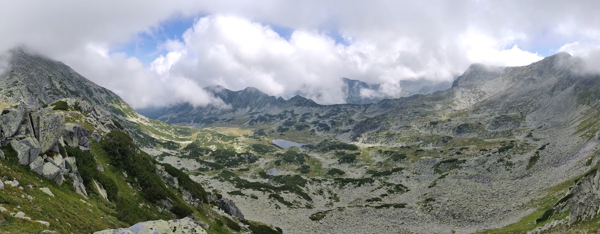
As you get closer to the summit of Păpușa you get another amazing panoramic view of the entire mountain range. On a clear day, you see from Retezat to Peleaga and all the way to Vârful Mare and Galeș towards the northeast. In front of you lies the stunningly beautiful Valea Rea, with its seven lakes and rocky terrain.
We took another short break on the mountain top, but it was still early in the day so we decided to extend our hike. We had two options. Either to continue on the red line towards Porțile Închise, a very technical trail, or to take a short trip around the lakes in Valea Rea. We went for the second one, since the first option involved climbing back on Păpușa for a second time.
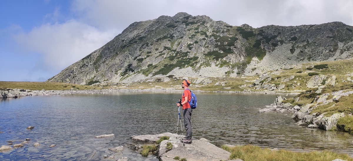
From the saddle between Păpușa and Peleaga, you can take the red cross trail to goes towards Galeș lake. The trail starts with a very rocky descent and then zig-zags the valley floor around the lakes. It was really beautiful and peaceful compared to the trail towards Peleaga which was getting crowded by mid-day.
To get back to Bucura, we had to climb on Peleaga again, since all the trails go straight across the peak. Again, we decided to take another trail back to Bucura.
So, from Peleaga we continued on the red line and we went up and down the final peak of the day, Custura Bucurei (2370m). On the way to Custura Bucurei, we also passed by the jagged rocks known as Colții Pelegii, a popular mountain climbing spot.
From Custura Bucurei, we went down towards Curmătura Bucurei, where we followed the familiar blue line back to the campsite.
Our second day in Retezat was a bit more difficult, with more than 6 hours of walking, but also with longer breaks, since we had the breakfast on Peleaga. However, the weather was better and we were able to admire the mountain range in all its beauty for most of the time. You can follow the hike we did on Relive. Make sure you grab enough water from Bucura, as the hike follows the main ridge which is dry.
Impressions
Everyone know Retezat has some of the most beautiful places in Romania, but you have to see it first-hand to really understand their beauty. In the past few months, we had the opportunity to hike in most of the mountain groups in Romania but the Retezat experience was special. The way in which the lakes, the rocks and the forests mix up to create the landscape is truly unique.
On top of that, Bucura is probably one of the most beautiful campsites in Romania, even though it can feel crowded at times. We will surely come back here as often as we can.
We hope this article gave you a quick taste of the camping experience in Retezat. What are some of your favorite mountain destinations in Romania? Let us know on social media and stay tuned for more hiking recommendations from our beautiful country.