🌎 Patagonia
8 min read
Introduction
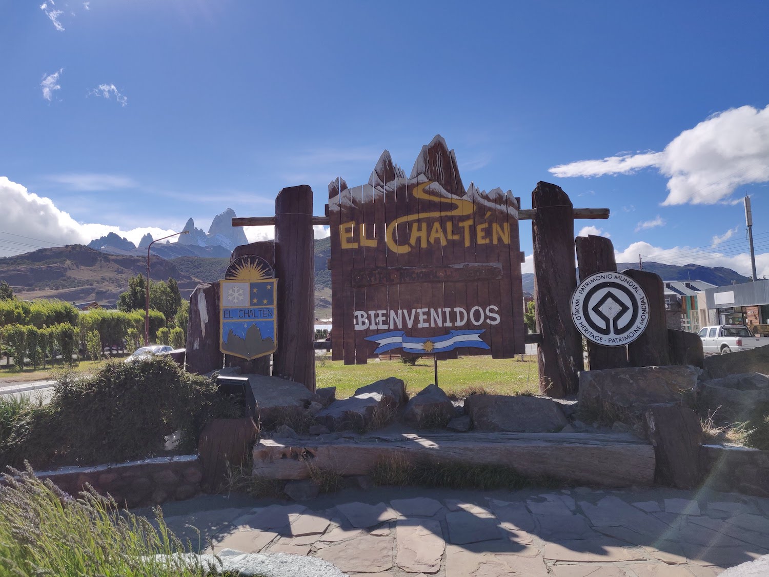
El Chalten is a small mountain village in the south part of the Argentinian Patagonia. The closest airport is about 3 hours away in El Calafate, the major hub of the area. El Chalten is the starting point for a number of trails and circuits that can take from 2-3 hours to 5-6 days.
The town is mostly active in the summer months (December - March) and it receives a lot of visitors during that time so make sure you book your accommodation in advance because most of the hotels will be fully booked when you arrive.
This is a very remote location, so don't expect luxury hotels and restaurants. It is pretty much packed with mountain loving people so you'll find the atmosphere very relaxed and friendly. The hotel owners are super friendly and will give you all the advice you need for spending your time around: where to eat, where to shop, what hikes to do, etc.
Days trips/hikes
While in Patagonia, you should keep an eye on the weather forecast. We heard of travellers that spent one week in El Chalten and only got 1-2 days of good weather for hiking. So be prepared for rain and snow, even in the middle of the summer.
We spent 3 days in El Chalten and we were fortunate enough to have 2 days of decent weather and only one day of heavy rain and fog. So here are 3 activites that you can do during your stay. Two of them are full day hikes and one is a day trip booked with a local company.
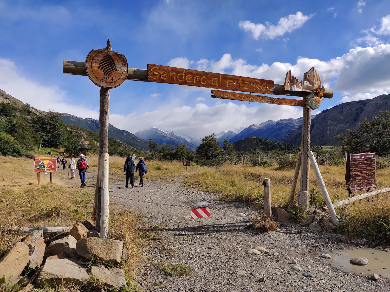
Laguna de Los Tres
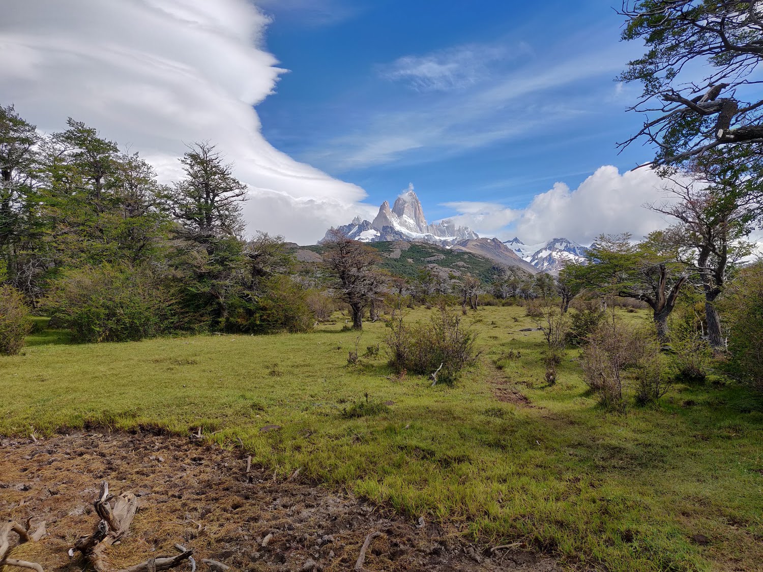
This is probably the most popular one day activity in El Chalten. It allows you go get a closer look at the highest peak in the area, Mount Fitz Roy. It involves about 20km of hiking (10km one-way) through the beautiful Patagonian landscape.
The hike starts at the north end of the town and is called "Sendero al Fitz Roy", can't miss it. As you start hiking you have markers every km so you know how where you are. If you are there during the high season it is most likely that you will see a lot of people taking the same trail, so you don't have to worry about getting lost or anything. Just enjoy the landscape and the Patagonian air.
We had mixed weather in the morning as we started hiking. We had sun, fog, rain and snow in a two hour interval, so you can really say you are experiencing all seasons in one.
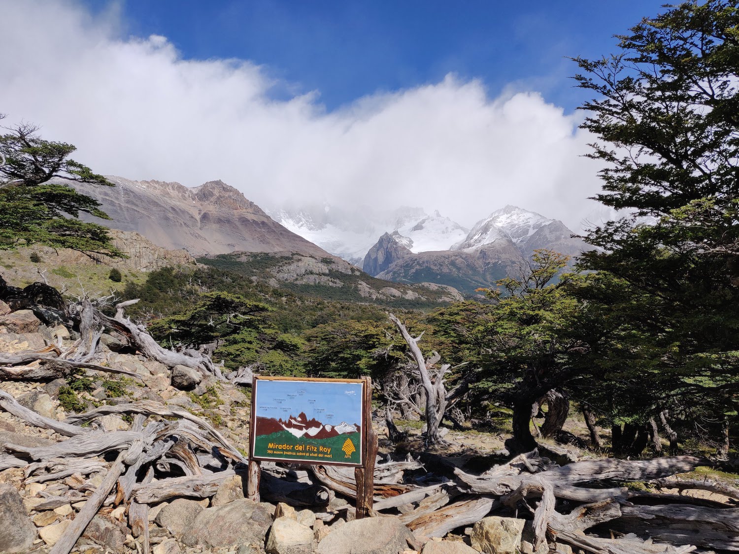
After 4-5km of steady climbing you arrive at a small fork where you have two options: either walk by Laguna Capri or go to Mirador del Fitz Roy. The path merges again after a few hundred meters, so you don't worry about missing too much.
If the weather is clear (not the case for our morning) the viewpoint towards Fitz Roy is amazing, both from the Mirador (mirador = viewpoint in spanish) and from the Laguna Capri. From the Mirador, you can also see the end point of the trail, the steep climb towards Laguna de Los Tres.
After this point, the trail continues pretty flat for 2-3km until you reach Camp Poincenot. From here, you have several other routes that you can take if you plan on spending multiple days hiking in the area.
A side note here is that there are toilets (wooden, not that clean, but toilets nevertheless) in this camp, as well as in the other smaller camps along the way. You're welcome to use them, but bring some toilet paper / paper tissues with you.
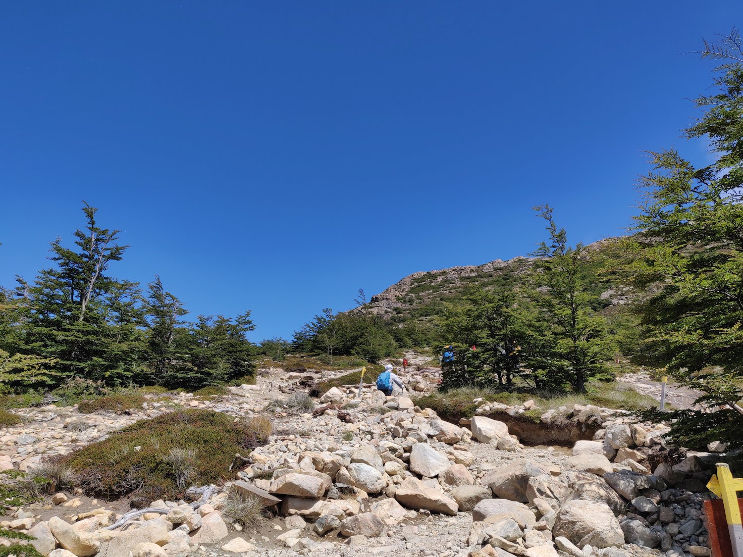
The last part of the hike is a steep climb towards Laguna de Los Tres. You get some 400m of vertical climb in about 1km, so make sure you stay hydrated and take some breaks along the way.
However, at the end of the climb you get rewarded with the most spectacular sight of Mount Fitz Roy and the lake.
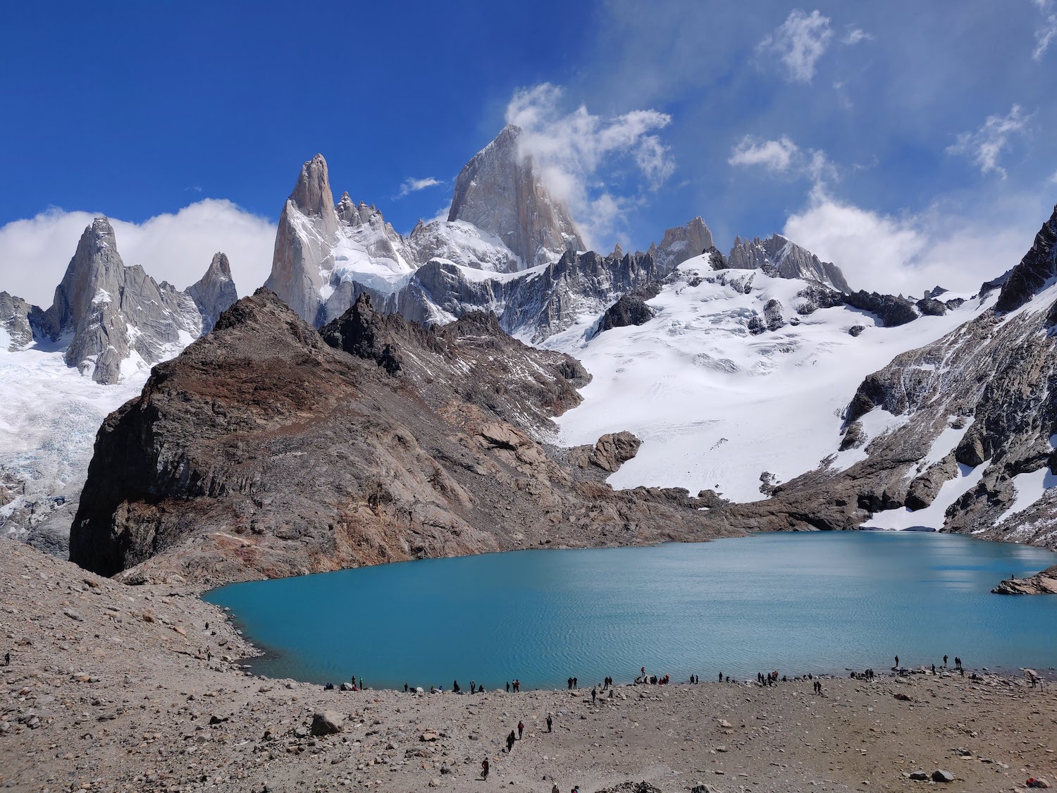
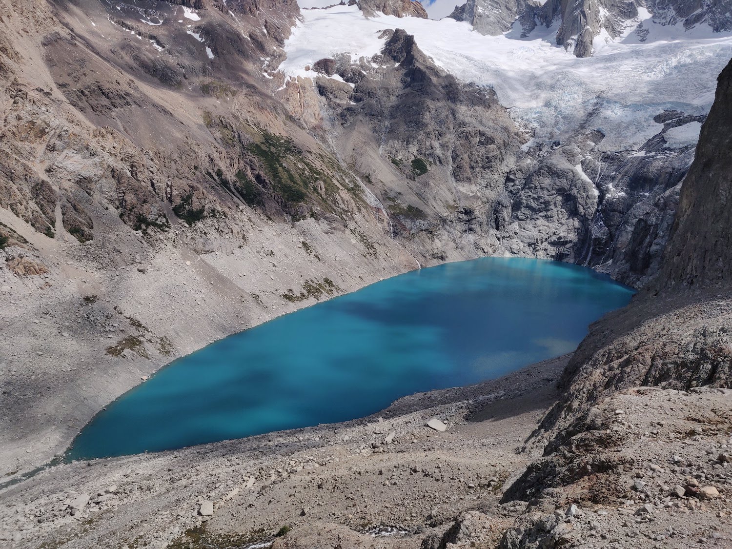
There's a ridge on the left side of the lake that you can climb and you get an awesome view of both Laguna de Los Tres and Laguna Sucia. The latter has an incredible milky blue color that looks unreal.
From the lake shore, the return hike to El Chalten is pretty much a leisure walk, mostly downhill. The only tricky part is the descent from the lake to the camp, the same 400 meters you ascended before. We were lucky to enjoy a sunny afternoon and got a very nice viewpoint towards the mountain on the way back.
All in all, the hike could take anything between 10 and 12 hours, depending on how much time you want to spend at each stop. The total altitude gain is 700m. You can read more about the technical details of the hike and also check out the map on this website.
Loma del Pliegue Tumbado
Most people will recommend a different hike for your second day, to Laguna Torre, for a nice view of the Cerro Torre, another famous mountain in the area. But if you prefer a more difficult challenge and you have a clear weather, you should definitely do the hike to Loma del Pliegue Tumbado.
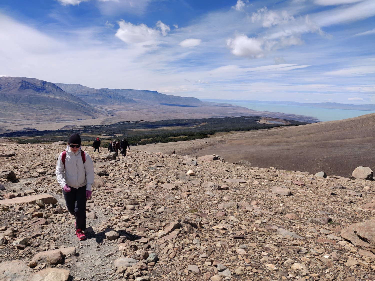
Unlike the hikes to Laguna de Los Tres and Laguna Torre, this one actually involves going up the mountain to an amazing viewpoint. But don't worry, it's not that steep and it's definitely not too difficult for anyone with a decent level of fitness. You will experience much stronger winds, because you are in the open mountains.
Make sure you bring a pair of glasses that protect you from the strong wind
The hike starts from the south part of the town, from the Visitors Center. Inside the Visitors Center, you can ask the rangers about the weather forecast for the day. Unlike the hike to Laguna de Los Tres, this one is very steady going up and doesn't have any big vertical climbs. The total altitude difference is about 1100m until the top of the mountain and 900m until the viewpoint.
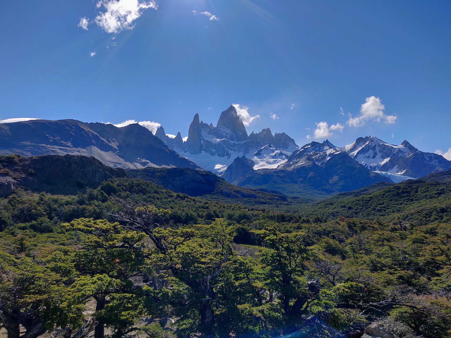
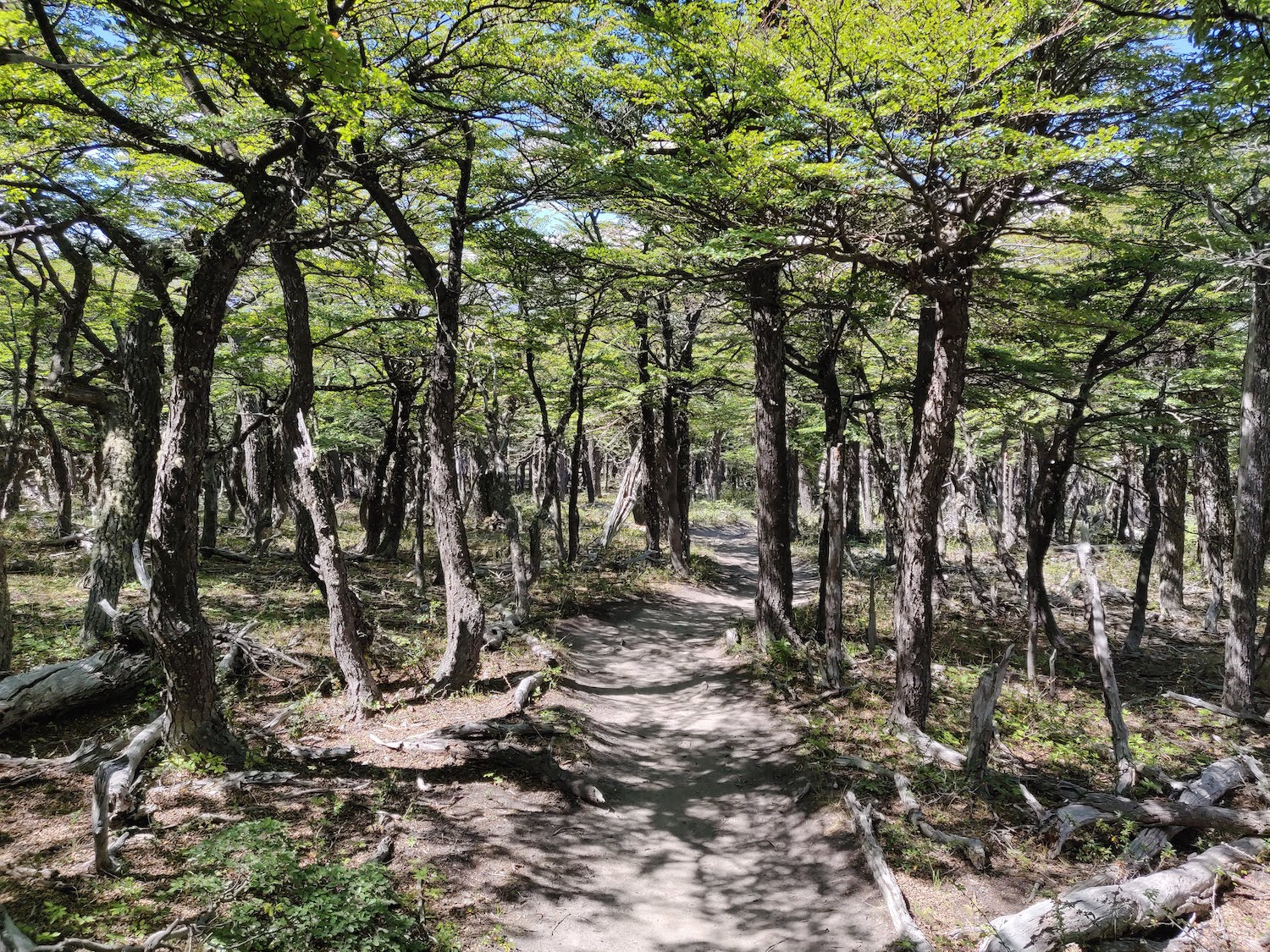
After 1km or so, you start seeing the magnificent Fitz Roy on your right side. The mountain will follow you for the next 2-3km. After a junction with another trail, you enter a beautiful forest of secular lenga trees. The trees are not taller than 4-5m because of the strong winds, so you get the feeling of walking through a tunnel.
When you exit the forest you start feeling the real power of the Patagonian wind. We had a particular windy day when we went, but we were told that you experience strong winds pretty much every day. Now, let's define strong winds. There were time we had to stop every 100m or so to wipe our tears and rest our legs, so powerful was the front-blowing wind. Eye glasses are mandatory at this point!
But the reward is there at the end of the climb. You get to an opening with a signpost: Loma del Pliegue Tumbado.
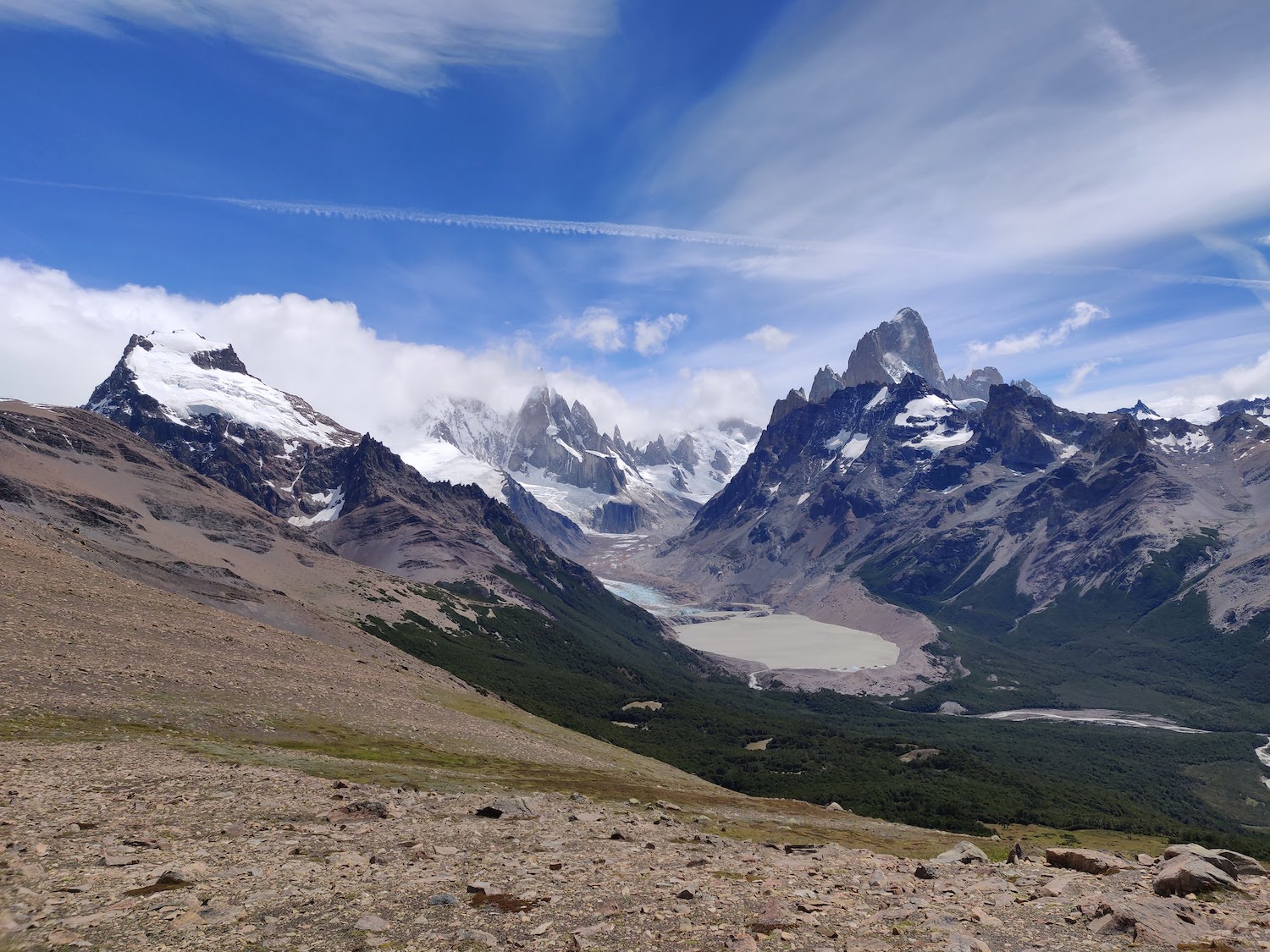
This is the viewpoint, the mountain top itself is another 200m up and you have to decide if you want to proceed. The wind was still strong so we decided to camp behind some rocks instead of going up to the mountain top. Words and pictures don't really describe the beauty of this viewpoint. You have the entire valley of Lago Torre beneath your feet and you see the mighty Fitz Roy and the Cerro Torre, one of the hardest mountains to climb in the area, with its ice-capped tip. Beyond Cerro Torre, you have the endless white of the South Patagonian ice field.
Together with the return trip to El Chalten, the hike should take you 7-8 hours at a steady pace, including time for stops along the way. You can check the same website for additional details about the hike and the map of the area.
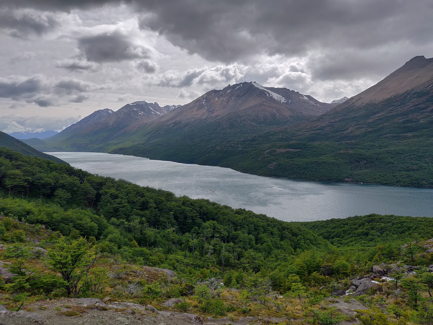
Lago del Desierto
This activity is doable on good and bad weather. We had a bad weather forecast for our final day in El Chalten, so we went to a local travel agency, Exploradores Lago del Desierto, and booked a trip to Lago del Desierto. The lake is 15km from El Chalten and is accessible via a pretty bad road. Renting a car is also an option, but it is a bit more expensive. The day trip starts from the center of El Chalten and you are taken to the lake with a small bus.
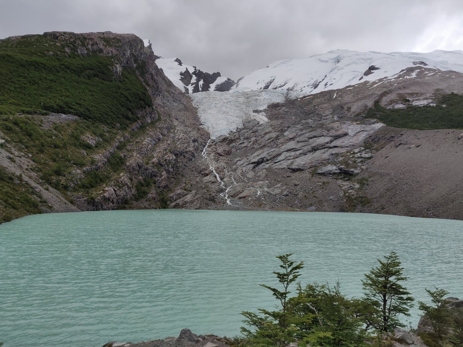
Once you are at the lake shore, you get on a boat for an hour cruise until roughly half the length of the lake. This is where you get off for a short hike to the viewpoint to the Vespignani glacier.
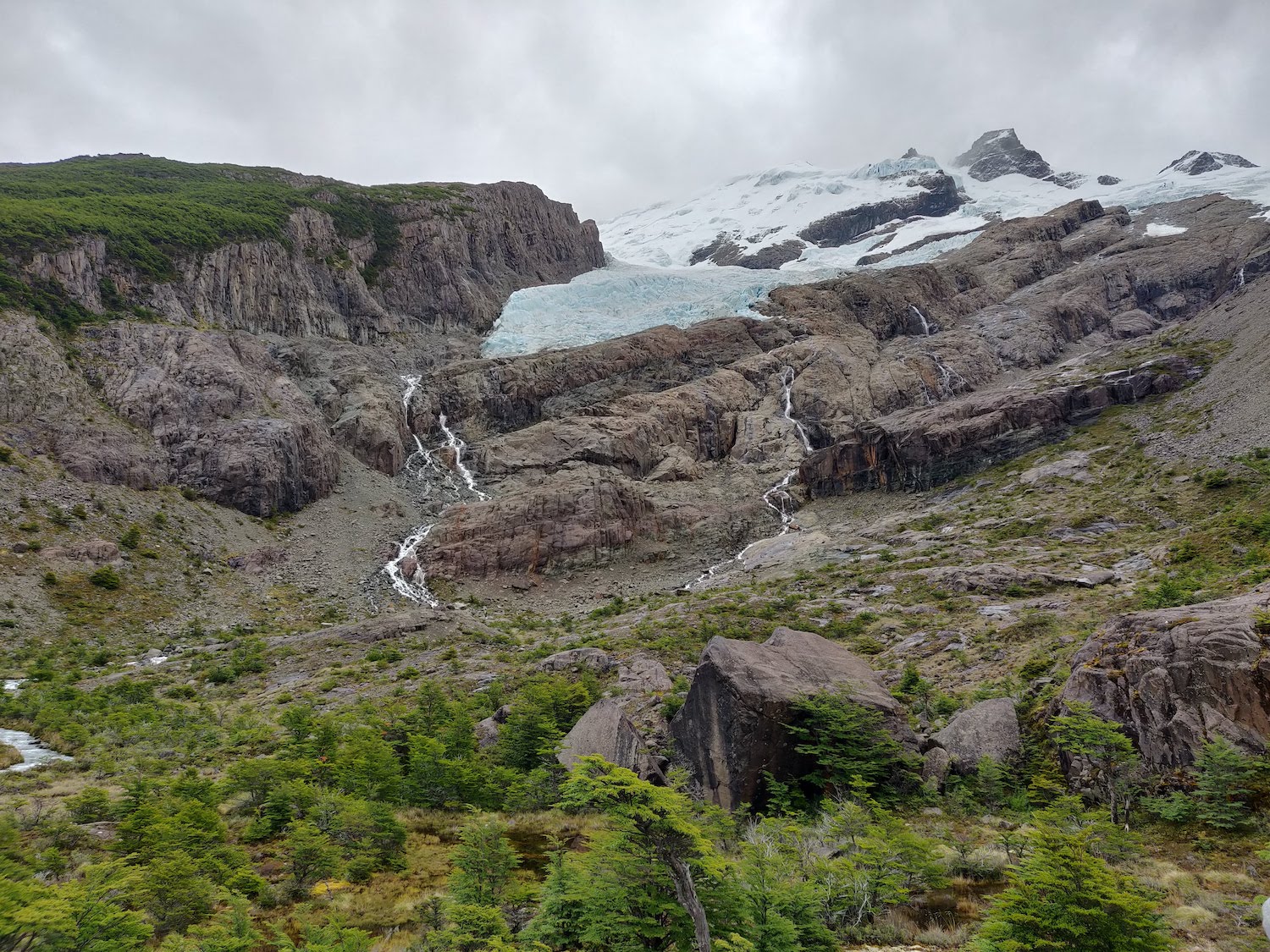
The hike up and down the mountain is mostly through a very dense green forest. You actually climb along a series of milky blue waterfalls.
At the end of the hike, the organizers offered us some biscuits and hot chocolate, which was more than welcome considering the cold wind and the rain we experienced for the past hour.
Then the trip continued on the boat and back to the shore of the lake, where we started another short hike, albeit a bit steeper, towards the Huemul lake and glacier. The landscape is pretty similar, but the lake at the bottom of the glacier offers a much nicer perspective.
After the trip to Huemul glacier, we returned to the bus for the trip back to El Chalten.
We definitely recommend taking this trip from El Chalten, especially if you don't have favorable weather for a full day of hiking. The landscape is a bit different than what you have around El Chalten with denser and wild forests.
Travel tips
El Chalten is an amazing destination, not to be missed when you are touring Argentina. It is truly the capital of hiking and trekking.
Keep in mind that the weather in Patagonia is unpredictable, so you might end up with four seasons in a single day. Our recommendation is to wear multiple layers so you can adapt to the weather. Also, the weather changes really fast, so don't stop to add or remove layers every time you are a bit cold or hot, or else you'll end up doing that every 5 minutes.
Always carry a light rain coat/poncho, you never know what the day holds.
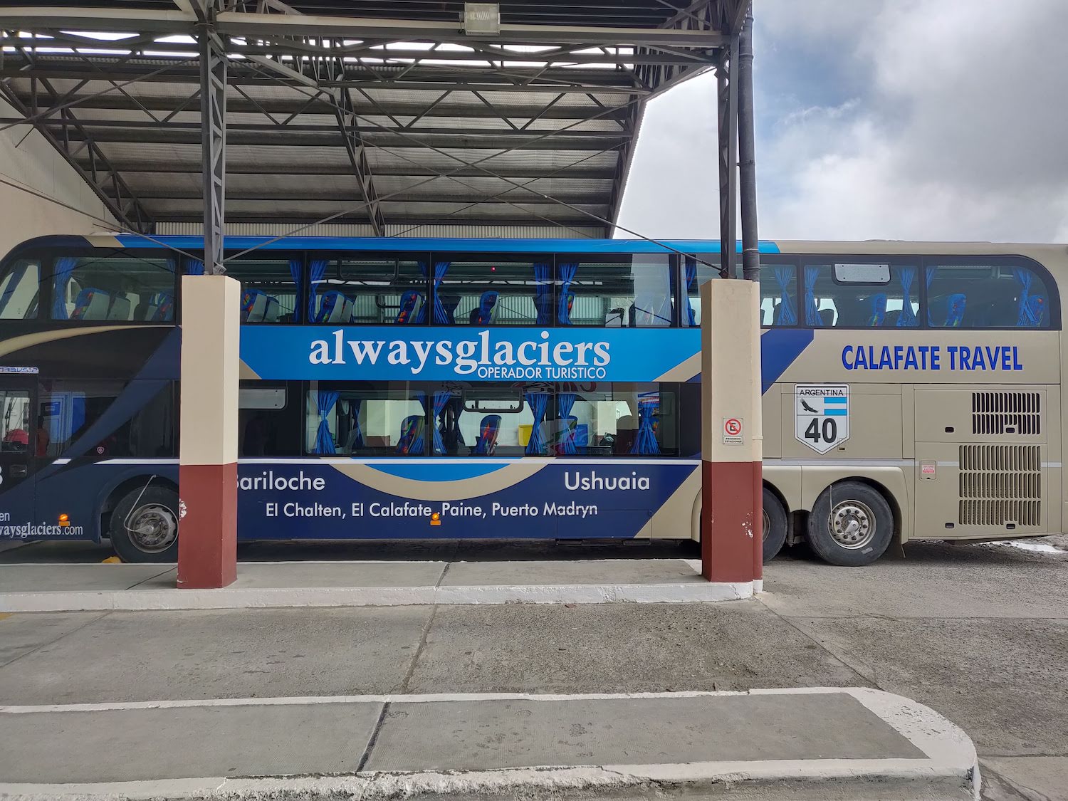
El Chalten is about 3 hours away from El Calafate by bus. You can also take a bus directly from the El Calafate Airport. We booked our tickets with Always Glaciers, one of the many local companies that do tours but also offer transportation between different places.
There are a couple of supermarkets in El Chalten, but they aren't always well supplied. There's also a very good local shop with fresh dairy and meat (it seems to be closed now, though). Besides these, there are a bunch of sport equipments stores that sell very good snack bars, perfect for long hikes.
We stayed at a clean hotel with very kind hosts. They helped us plan our day trips and recommended places to eat. Speaking of, close to the hotel there are two very cosy restaurants owned by local people: one for meat lovers with excellent parilla (steak) and one with more generic food.
Almost everybody that flies to Patagonia has a backpack, and a lot of them are the same, so they're really easy to confuse. Make sure to have a distinctive mark on yours. Also, prepare for little to no internet for a few days, you will love it :)